SI-TEX SRA-1 Rudder Indicator f/Use w/SP70 80

SI-TEX SRA-1 Rudder Indicator f/Use w/SP70 80

SRA-1
Rudder Angle Indicator
Displays precision analog position reading.

A quick, positive, visual indication of rudder angle can be very important when docking or maneuvering a boat in tight quarters. It can save not only your gel coat but your pride. The SI-TEX SRA-1 Rudder Angle Indicator gives you a precise look at exactly where your rudder is positioned.

An easy-to-read 3-1/8″ diameter analog faceplate displays, in high resolution, the rudder position from zero through fifty degrees to either port or starboard. High visibility white characters and scale registrations, along with red and green directional markings stand out from a black background. Where many other analog rudder angle indicators have a pointer at the twelve o’clock position on the dial, the SRA-1’s zero position is at six o’clock. This configuration has the advantage of being more intuitive. The indicator moves in exactly the same way as the rudder relative to the boat.

The SRA-1 is designed for use with the SI-TEX SP-70 and SP-80 Autopilots, as well as others equipped with a rudder feedback transducer and an output connector for a rudder angle indicator. It will fit a standard 3-3/8″ circular instrument cutout in a dash, or it can be mounted in an optional watertight ABS plastic case. Up to five SRA-1 units can be connected to a single SI-TEX autopilot.

Poly-Planar MA-4056 6″ 80 Watt Speakers – White

Poly-Planar MA-4056 6" 80 Watt Speakers - White

MA-4056 6″ 80 Watt Speakers – White

MA-4056 is a 6″ cone size two-way coaxial speaker.  This speaker featured a rugged waterproof design, Teflon coated wires, plastic grills, polypropylene cones, mylar tweeters and plastic frames, to provide years of trouble-free service. 

Ultra-low magnetic field speakers eliminates the problem of speakers magnets affecting navigation equipment such as compasses and autopilots. 

Features:

  • Ultra-low magnetic field speaker
  • Ideal replacement speakers for boaters who want to upgrade to waterproof speakers without changing the cutout size
  • Integral grills allow for simple, one-piece installation
  • Stainless steel mounting hardware included

Specifications:

  • Type – 2-way Coaxial
  • Cone Size – 6″ (152mm)
  • Speaker Impedance – 4 ohms
  • Peak Power – 80 watts
  • Continuous Power – 40 watts
  • Weight – 1.55 lbs per speaker
  • Outside Diameter – 7-3/16″ (182mm)
  • Cutout Diameter – 5-1/4″ (132mm)
  • Mounting Depth – 2-9/16″ (65mm)

*Sold as a Pair

This product may not be returned to the original point of purchase. Please contact the manufacturer directly with any issues or concerns.

Posted on Leave a comment

Boat Electronics For Beginners

Boat Electronics For Beginners 

If your boat has aging or outdated electronics or you need to update a “new to you” boat that you’ve just purchased, the options out there can be overwhelming. 

Whether you are a beginner boat owner that is just now getting involved with your own boat electronics purchases or looking to upgrade your current setup to prepare for your next trip on the water, we have put together a comprehensive guide to some of the most common boat electronics. 

In the last decade or so, advances in technology have allowed boat manufacturers and electronics inventors to make smaller and more efficient boating electronics and devices. While not every boat needs to have all the bells and whistles that are available, many of these new devices make boating safer, more approachable, and more efficient. 

Electronics For Your Boat 

The use of each electronic device will depend on the size, location, and use of your boat; however, many of them can be used on almost any vessel–such as AM/FM radios, Emergency signaling, and chart plotters. 

Many of these items and electronics are interchangeable at different boating “levels” of knowledge and experience, depending on the type of boat you have and how you plan to use it. For example, an experienced boater may use several multifunction displays (MFD), while a beginner boater would only need a very basic chart plotter or MFD to get them started. For water sports enthusiasts and cruisers, a tricked-out stereo and entertainment system is a must, whereas an offshore angler may not place as much importance on keeping the tunes flowing. 

Whether you’re an offshore angler, freshwater angler, have a family day boat, are a water sports enthusiast, or have a cruiser, we have an easy to understand list of the types of boat and marine electronics you’ll likely need for going out on the water. 

The Basics: For Boat Beginners 

These items should be on the basic electronics list for the average boater and can help everyone onboard have a safe, fun time. 

  • VHF RadioMarine VHF radio is a system of two-way radio transceivers that is used worldwide for ship to ship and ship to shore communication. It reaches 30-50 miles and is the primary way that boats communicate while on the water and is important for boat safety. Consider a handheld backup VHF radio for boating longer distances. 
  • Entertainment (AM/FM Radio, Music Player)–Even if you don’t feel the need for a TV onboard, most people will want some music or a way to play songs from their phone, iPod, or mp3 player. 
  • Chart Plotters–A chart plotter takes GPS information and plots it on a digital map. This device is a great way to navigate, especially on longer trips with no definite points of reference (such as offshore trips and blue water sailing). Consider using a handheld device for longer distances. 
  • Depth Sounders/Fish Finders–Depth sounders, as their name suggests, are used to tell you the depth of the water, which is useful in areas with rocks, hazards, and sharp drop-offs. Fish finders use sonar to locate fish and other solid objects underwater. There are also combination devices available to provide dual functions of each. 
  • Emergency Signaling Device–The two most common devices are Personal Locator Beacons (PLB) and Emergency Position Indicating Radio Beacon (also known as EPIRBs). PLB’s are registered to a person and EPIRBs are registered to a vessel. Both devices send a coded message on the 406 MHz distress frequency. 
  • GPS Speedometer–This device measures the speed of your boat and is helpful for keeping speed steady so that wakeboarders and water-skiers can hit the water at a safe and constant speed. These controls allow you to set the exact desired speed and change them in 1-mph increments. 

The Prepared: For Weekend & Regular Boaters 

For the more experienced boater, a few electronic additions can make the entire experience go smoother. From taking better stock of your surroundings to measuring efficiency, these devices will help you gain better understanding of your boat and navigate with ease. 

  • Autopilot–For extended periods of boating and areas where the navigation is simple, don’t leave home without your autopilot device. It can also be connected to other devices such as GPS and MFDs. 
  • Radar–Radar works similar to fish finders, but instead of alerting you to solid objects below, it tells you about what objects are around you. Radar is extremely helpful for boating in fog or the dark. Use radar in low visibility situations and to stay alert of other boats. 
  • Alarms–These days, there is an alarm for almost everything. Alarms can help notify you when certain parts of your boat require your attention. Get notifications if a pump stops working, your boat drifts too far off course, or if there is smoke or carbon monoxide detected. 
  • Automatic Identification System (AIS)AIS is an automatic tracking system that uses ship transponders to broadcast the vessel’s name, direction, and speed. This is especially useful for avoiding collisions with large, fast moving ships and hailing boats which are too far away to read. 
  • Instrument System–Install a comprehensive instrument system to tell you the current water depth and temperature, boat speed, wind speed and direction, impending weather, and more. The system can be networked to your GPS and autopilot to make navigation easier. 
  • Networked Multifunctional Display (MFD)–With the same chart plotting and fish finding functions as a standard chart plotter, an MFD offers additional functionalities such as displaying all navigation info from different units, programming routes, sonar, alarms, fuel/temp/AIS monitoring, and more. 
  • Onboard Battery Charger–For those with electric motors, a battery charger is a must. With an onboard charger, you don’t have to worry about dragging a charger to the boat or cutting your time on the water short.  
  • Fuel-Flow Meters–Fuel flow meters determine the rate of flow from the boat’s fuel tank to the engine. While they can’t tell you how full the tank is, they are useful for engine efficiency and alerting you to any issues before they might require costly fixes. 

The Electronics Enthusiast: For Those That Have It All 

In addition to the boat basics and more advanced options that many regular boaters have, these items are for the boater that likes to have it all or frequently uses their boat for specific purposes. Many of these electronics are for boaters that find themselves away from the inland coast a good portion of the time as well. 

  • Satellite Phone–Don’t worry about signal reliability with a sat phone. Call, text, send and receive emails, check the weather, surf the internet, and more. A sat phone is a good investment for those that spend a lot of time on the water but want to stay connected. 
  • SSB Radio–This type of radio is similar to the VHF, but it has an ocean-sized range. A medium frequency SSB radio has a range of around 400 nautical miles, while a high frequency will reach out for several thousand miles. 
  • Infrared Camera & Night Vision– Infrared cameras provide thermal imaging that can be integrated into MFD screens. Night vision vison allows you to see obstacles in low light conditions for those late nights or early morning out on the water. 
  • Satellite Weather– Don’t leave it up to the weather channel. Get real-time Doppler radar weather, right on your chart plotter screen. Stay aware of incoming storms or changing weather conditions. 
  • Entertainment Center–For the large cruiser or water sports enthusiast, media and entertainment are a must. From an integrated radio for music and great speakers to satellite TV, a DVD player and more, there are endless options to keep everyone onboard entertained. 
  • Cartography–Whether inland for popular lakes or for general coastline, there are plenty of cartography chip options to make your navigation flawless. Choose from popular maps and imaging and stay aware of changing water features. 
  • Cell Amplifier–For those that aren’t ready to take the plunge and invest in a satellite phone, a cell amplifier can extend the working range of your phone out 30-50 miles from the nearest tower. It makes a great addition for shorter trips close to the coast. 
  • Gyroscopic Binoculars–Minimize image shaking and view far off vessel names, overhead birds, incoming lights, numbers on buoys, and more. 7x50s or seven times the magnification with a 50-mm objective lens is the standard for boating binoculars. 

Get Boat Electronics 

Shop the best quality marine electronics & boat accessories at the lowest prices online at Atlantic Marine Depot. Ensure that your boat has everything it needs, before it hits the water. We offer fast, free shipping on all orders over $99. Get marine electronics & boat accessories at the lowest prices. Shop our online inventory for the best marine electronics & boat accessories for commercial boats, pleasure vessels, and fishing boats. 

Minn Kota Terrova 80/US2 Trolling Motor w/i-Pilot & Bluetooth – 24V-80lb-45″ – *Remanufactured

Terrova 80/US2 Trolling Motor w/i-Pilot & Bluetooth – 24V-80lb-45″ – *Remanufactured

CHALLENGE ACCEPTED.
How can you possibly improve a motor? By making it easier than ever to stow it with an innovative Lift-Assist mechanism. Now you get brains, brawn, and effortless control of it all. Hey, we like a challenge.

Lift-Assist
An updated Lift-Assist mechanism on the redesigned Terrova carries the weight of the motor for you to make stowing easier – so you can save your strength to reel in the big ones.

Redesigned Stow/Deploy Lever
Terrova’s Stow/Deploy lever has been redesigned to allow for one-step stow or deploy – making it even easier to use. Just push down with your hand or foot when you’re ready to move.

Quieter Steering Motor
These Terrova’s have a completely updated motor design – engineered to run quieter than ever before. So fish won’t be spooked, but you might be.

i-Pilot w/New Phone App
Boat positioning becomes automatic with the redesigned, GPS-powered i-Pilot system. i-Pilot lets you set Spot-Locks, record paths, control speed and steering, and more. i-Pilot system features reinvented Spot-Lock – the most accurate electronic GPS anchor ever – and have redesigned remotes with largerscreens, more options, and Bluetooth technology, so you can connect to your smartphone for quick control of basic functions and easy software updates.

Terrova Foot Pedal
Whether you steer heel/toe or right/left, Terrova’s electric-steer, waterproof, low-profile foot pedal has you covered. Responsive, precise control from anywhere on the boat with less than one degree of steering resolution. Plus, a new Spot-Lock button lets you hold onto your fishing spot directly from the foot pedal. Never requires batteries. Includes 18 foot cord.

Push-to-Test Battery Meter
Terrova’s Push-to-Test Battery Meter gives you an instant “state of charge” reading at the push of a button, so you can see just how much longer you have on the water.

Weedless Wedge 2 Prop
Push weeds away and take on the thick stuff without battery-draining chopping and hacking. Weedless Wedge™ 2 features swept-back, flared blades for unrelenting, reliable prop performance.

Advantage Minn Kota
Indestructible Composite Shaft: Pound for pound, our composite shaft is stronger than steel. It flexes on impact and won’t break, kink or corrode. That’s why we’re confident enough to guarantee it for life.

Cool, Quiet, Power:Nothing runs cooler or quieter than a Minn Kota. Our extra large windings and commutators dissipate heat, resulting in cooler operation, extended battery power, and longer motor life. And our unique bearing system reduces friction to cut fish-spooking noise.

1-Year Warranty
This motor is backed up with Minn Kota’s 1-year warranty.

Specifications

  • Control: Remote and Foot Pedal
  • Volts: 24
  • Max Thrust: 80 lbs.
  • Shaft Length: 45″
  • i-Pilot
  • Universal Sonar 2
  • Speed Control: Variable
  • AutoPilot: Incl. on i-Pilot
  • Max. Amp Draw: 56
  • Prop: Weedless Wedge 2 (MKP-33)

WarningWARNING: This product can expose you to chemicals including di(2-ethylhexyl)phthalate (dehp) which is known to the State of California to cause cancer, birth defects or other reproductive harm. For more information go to P65Warnings.ca.gov.

Raymarine Axiom™ 7 – 7″ MFD Chartplotter Only w/LNC Chart – Lighthouse USA

Raymarine Axiom™ 7 - 7" MFD Chartplotter Only w/LNC Chart - Lighthouse USA

Axiom™ 7 – 7″ MFD Chartplotter Only with LNC Chart – Lighthouse USA

The Axiom™ is a powerful multifunction navigation system from Raymarine. The Axiom 7 features a 7-inch rugged all-glass touchscreen display and is powered by Raymarine’s powerful LightHouse 3 operating system and a supercharged quad-core processor.

Axiom 7 is expandable so its capabilities can grow as needed. It supports the full range of Raymarine accessories including Quantum radar, CHIRP Sonar, FLIR thermal cameras, audio integration, instruments, cameras, and Evolution autopilot. Standard Wi-Fi and Bluetooth connectivity allows connection to the latest Raymarine apps for tablets and smartphones.
The Axiom 7 is bundled with LightHouse USA Coastal Vector charts on MicroSD.

The Axiom 7 includes surface and trunnion mounting kits, mounting hardware, power/data cable, and installation instructions.

Features:

  • Rugged, All-Glass touch screen display delivers a big screen experience in a small footprint. Optically bonded for brighter colors, sharper contrast, and sunlight visibility
  • LightHouse 3 OS is fast, fluid, and easy to learn. An uncluttered interface that is easily personalized for your style of navigating.
  • Fast 10 Hz 72 Channel GPS/GLONASS Receiver for rapid position and heading updates and smooth on screen tracking
  • Support for the best charts from Navionics and LightHouse Raster and Vector Charts sourced from leading map makers like NV Digital, Blue Latitude, and more
  • Navigate Safely at Night with the optional FLIR M100 and M200 compact marine thermal cameras
  • Quantum CHIRP Radar Ready – Superior solid state CHIRP radar delivers no compromise performance on long and extremely short ranges
  • Marine Audio Control – Turn up the volume and control NMEA2000 compatible marine audio systems like Rockford Fosgate
  • Ready to Network with Raynet Ethernet and NMEA2000. Connect multiple Axiom displays or expand with Quantum, HD radar, IP cameras, engine gauges, autopilots, instruments, and more.
  • Built-in Wi-Fi lets you to stream and control Axiom right from your smartphone or tablet. You can also sync Axiom’s waypoints, routes, and charts with Navionics mobile apps

Garmin GPSMAP® 7607 7″ Chartplotter w/J1939 Port, LakeVü HD & g2 Charts

Garmin GPSMAP® 7607 7" Chartplotter w/J1939 Port, LakeVü HD & g2 Charts

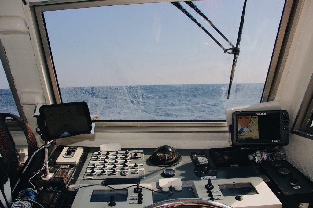
GPSMAP® 7607 7″ Chartplotter with J1939 Port

7-inch Fully Network Capable Chartplotter

  • 7-inch multi-touch widescreen display (800 x 480 WVGA) preloaded with both BlueChart® g2 U.S. coastal and LakeVü HD maps
  • High-sensitivity internal 10 Hz GPS/GLONASS
  • Fully network capable for Garmin Marine Network and NMEA 2000®, plus NMEA 0183 support
  • Supports GSD™ premium sonar and GCV™ scanning sonar modules
  • Advanced sailing and sail racing features

Designed for cruisers, sailors and sailing racers who demand high performance, ease of operation and feature integration, the GPSMAP 7607 chartplotter with 7-inch multi-touch widescreen display has a 10 Hz internal GPS that updates position and heading 10 times per second. It is fully network capable, including the Garmin Network and NMEA 2000, and offers the conveniences of built-in Wi-Fi® connectivity.

Preloaded BlueChart g2 maps

In addition to basic charts, tidal stations, currents, depth contours, IALA symbols and included fishing charts, BlueChart g2 offers smooth transitioning between zoom levels and more seamless continuity across chart boundaries. You can customize your screens with Safety Shading that allows you to shade all depth contours shallower than your boat’s safe depth. Fishing charts emphasize bathymetric contours with less visual clutter on the display. And there’s also a choice of standard 2-D direct overhead or 3-D “over-the-bow” map views for easier chart reading and orientation.

Preloaded LakeVü HD Maps

These highly detailed freshwater maps include 17,000+ U.S. lakes, rivers and reservoirs. Included in those are more than 13,000 HD lakes with 1-foot contours shoreline to shoreline; excellent detail of underwater features plus Shallow Water Shading that allows you to designate a minimum depth; interstates, highways, general roads and bridges; designated fishing areas; and points of interest, such as docks, boat ramps, marinas and campgrounds.

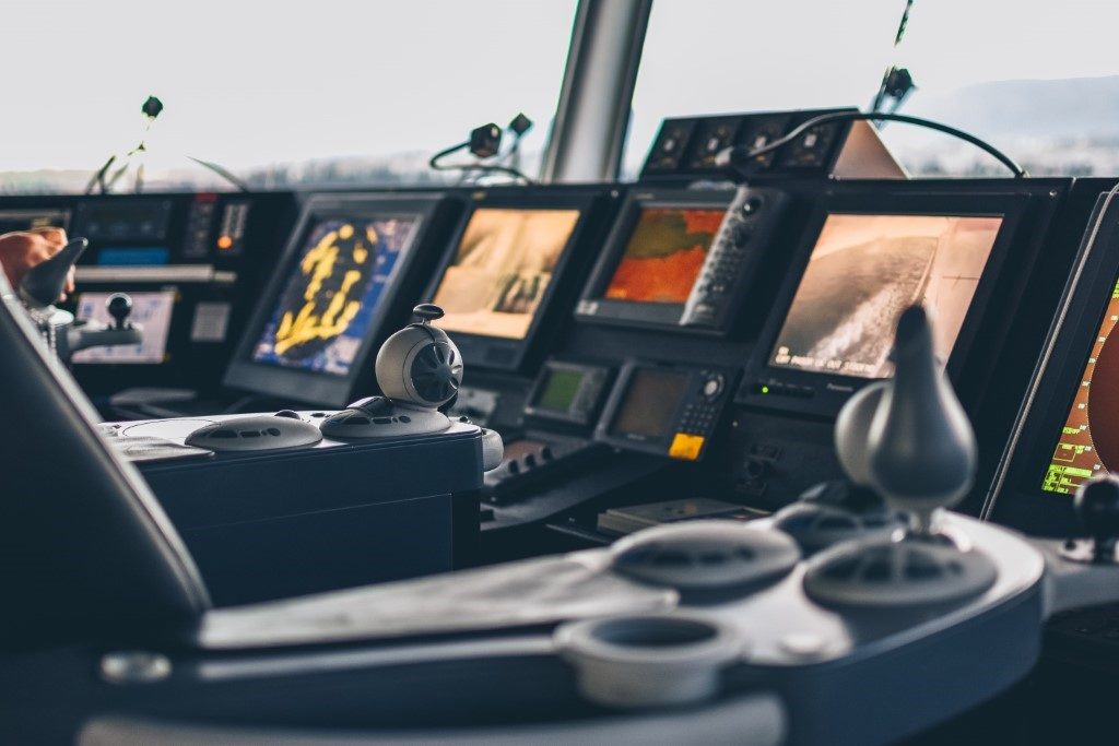
Garmin Marine Network and NMEA 2000 Support

Full-network compatibility allows you to add more capabilities to your boat. GPSMAP 7607 supports radar, autopilot, instruments, multiple screens, FUSION-Link, sensors, remote sonar modules, digital switching, thermal cameras, GRID rotary knob, joystick and keypad control, and more.

Add Array or Dome Radar

You can add your choice of Garmin marine radar, including our powerful xHD2 open array radars or xHD dome radars that pairs ease of use with advanced open array features.

Network Sharing

GPSMAP 7607 allows you to share features with other compatible GPSMAP units, such as radar, GCV 10 ClearVü and SideVü scanning sonar, GSD 24, GSD 25 and GSD 26 sonar modules, supplemental maps, and user data, including waypoints, routes and tracks. User data entered into 1 chartplotter can be automatically synced with other chartplotters in a network.

Heading and Position Refreshed 10 Times Per Second

Fast, responsive 10 Hz GPS/GLONASS refreshes your position and heading 10 times each second to make your movement on the screen more fluid. It makes dropping up to 5,000 accurate waypoints — and finding your way back to them — quick and easy.

Special Sailing Features

Supported sailing features include laylines, enhanced wind rose, heading and course-over-ground lines, true wind data fields and tide/current/time slider. Gauge displays are designed to provide important need-to-know information at a glance, including true and apparent wind angle, set and drift, true or apparent wind speed, horizontal or vertical graphs, and a data bar with customizable data fields.

Compatible with gWind™ Transducers

Garmin gWind, gWind Wireless and gWind Race transducers feature twin-fin technology with 3-bladed propeller. Connect to the NMEA 2000 and compatible Garmin chartplotters via the GND™ 10 black box bridge.

Black Box Interface

The GND 10 black box interface seamlessly integrates Nexus instruments and sensors with the Garmin family. It converts data between the Nexus network and NMEA 2000 to provide trouble-free compatibility between Nexus and Garmin products.

Upgrade with the Best Maps on the Water

Two microSD™ card slots provide expandable memory for accessory map purchases, such as LakeVü HD, LakeVü HD Ultra or BlueChart® g2 or BlueChart g2 Vision.

FUSION-Link Entertainment System

Enjoy the ability to control all compatible FUSION-Link-enabled audio systems directly from your compatible chartplotter display.

The Ultimate Connected Boating App

Built in Wi-Fi gives you access to the free all-in-one ActiveCaptain™ app, so you can manage your marine experience from nearly anywhere. It creates a simple yet powerful connection between your compatible mobile device and your Garmin chartplotter, charts, maps and the boating community. Wherever you are, you’ll have unlimited access to your cartography, the ability to purchase new maps and charts and access to the Garmin Quickdraw™ Contours Community. Stay connected with smart notifications on your chartplotter screen. You can also plan a trip or prefish a lake, and ActiveCaptain will automatically sync with your chartplotter. Even get notifications for software updates, and decide when to download them on your device.

Enhanced Auto Guidance

Just enter the location where you want to go and patented Garmin Auto Guidance² technology instantly searches through relevant charts to create a virtual pathway on the display that helps you avoid low bridges, shallow water and other charted obstructions en route.

Better still, with enhanced Version 2.0, you now have access to even more features and capabilities. You’re able to adjust the calculated Auto Guidance pathway by inserting “via” points at interim stops or landmarks along your desired route. You can easily review hazard points along your calculated path. And you can even engage your compatible Garmin autopilot to follow the Auto Guidance route, automatically. Other 2.0 enhancements give you the ability to calculate arrival times at any point on your route (great for timing arrivals to correspond with bridge openings and other time-critical events). Better still, you can now save your plotted Auto Guidance paths for future navigation by backing them up on an SD™ card with your BlueChart® g2 Vision® or Lake Vü™ HD Ultra cartography¹.

Simplified SOS Calling 

This exclusive SOS safety assist feature makes it easier for anyone – even those not familiar with marine electronics or radio protocols – to quickly call for Coast Guard help in an emergency. By simply tapping the SOS button on the chartplotter’s touchscreen display, your networked Garmin VHF radio will automatically tune to the Channel 16 emergency frequency and a list of possible situations (fire, man overboard, etc.) will be displayed. Once the applicable choice has been selected, the screen will provide a Coast Guard approved VHF radio distress call script, along with the ship’s current lat/long GPS coordinates, that can be read off to responders – thus saving time, averting panic, and providing the essential information needed by rescuers to assure the best possible outcome.

GPX Waypoints Transfer

If you have waypoints, tracks or frequently used routes stored on another manufacturer’s GPS product – or on a Garmin handheld device –  now it’s easier than ever to transfer those items to your new Garmin chartplotter, via industry-standard GPX software formatting. GPX is an open standard format for GPS data exchange across platforms and applications. With this easy-to-use interface technology, Garmin has taken “no waypoint left behind” to a whole new level of trade-up convenience.

Special Sailing Features

To help you gain a wind-maximizing competitive edge, your chartplotter features a pre-race guidance page that shows your virtual starting line, along with data fields showing laylines, time to burn before the start and a race timer that can be synchronized across all your networked Garmin GPS products. In addition, other supported sailing features include an enhanced wind rose, heading and course-over-ground lines, set and drift, true and apparent wind data and more. You can also use available built-in wireless connectivity to access and control a variety of marine-specific apps via compatible smartphones or tablets.

Panoptix™ Down Transducer

With 1 Panoptix Down transducer, you get 3 remarkable views, allowing you to actually see fish and bait swimming around under your boat – in real time. You can even see fish in the water column in 3-D, from the bottom to the surface. You can be stationary yet still see things in 3-D below your boat.

  • LIVEVÜ DOWN: Shows real-time moving sonar images below the boat. This screen shows bait drop echo trail movement in purple with sonar history data at left.
  • REALVÜ 3-D DOWN: Scans the area below the boat from front to back and side to side. This screen shows a school of fish sitting against the back side of vertical face, on Pport side of boat 35 feet deep.
  • REALVÜ 3-D HISTORICAL: Scrolls through the data as the boat moves to show the history of entire water columns – from the bottom to the surface and all of the fish in between. This screen shows the boat passing over a stream channel with a school of fish between 30 to 40 feet.

Panoptix Forward Transducer

One Panoptix Forward transducer provides 2 impressive views, even while your boat is stationary. It shows the bottom plus fish and bait swimming in the water column in front of your boat – in real time. You can even see your lure as you reel it in. You can also get 3-D views of fish and structure in front of your boat.

  • LIVEVÜ FORWARD: Updates are provided with a single ping, providing real-time moving images of what’s in the water. This screen shows a large target (a diver) approaching the boat.
  • REALVÜ 3-D FORWARD: Digitally scans the area in front of the boat, creating a forward-looking 3-D view of the bottom, structure and fish. This screen shows fish targets at 10 feet and drawing bottom depth of 20 feet.

Create your own HD maps

Quickdraw Contours is a free, easy-to-use software feature already installed on your compatible Garmin combo. It instantly creates your own personalized HD fishing maps with 1-foot contours. Tailor them to fit your needs. They are your maps — you own them. Keep the data to yourself, or share it with the Quickdraw Community on Garmin Connect™. There’s no special surveying expertise required. You just fish while it creates maps. You don’t have to wait around or send your files away like other mapping software requires — your results appear instantly. Use with any of the following sonar transducers:  Garmin Panoptix™, HD-ID™ traditional, CHIRP-enabled, Garmin ClearVü™ or NMEA 2000®-compatible depth. Have more than 1 sonar device installed onboard? Quickdraw Contours automatically selects the most capable sonar device to provide the very best results for you!

Multiple Depth Range Shading

Designate up to 10 different depth ranges each with its own color. Makes it easier to view target depths at a glance.

Commission Autopilot from Chartplotter

To make commissioning easier and more convenient, you can handle the entire autopilot commissioning process from your chartplotter screen.

Axis Camera Support

Garmin offers support for select Axis cameras, which can be used for surveillance and situational awareness on vessels of any size. Our integration allows you to view video on every screen on your boat and, if you wish, view multiple streams on the same screen. You can control your camera’s pinch-to-zoom and pan/tilt settings with gestures directly on the plotter screen. Use an Axis encoder to convert analog camera, such as Garmin GC 10, to video over IP.

Catch All the Action On the Water

This chartplotter supports wireless connections to Garmin VIRB® X and XE action cameras so you can catch all the action during your time on the water. More importantly, with a simple software update, you can control recordings, take still pictures, and stream video from a VIRB X/XE action camera to your GPSMAP® 7400/7600 series chartplotter or 8000/8400/8600 series Glass Helm chartplotter. In fact, you can stream video from up to 4 VIRB X/XE action cameras and view the video on a compatible marine chartplotter. You can even view previously captured images and videos on the chartplotter and display thumbnail previews for easy selection. Control play, pause, seek and replay from your chartplotter. There’s even an automatic slide show mode and the ability to delete unwanted VIRB images or videos. Each VIRB can be named for easy identification. You can also control your VIRB cameras to change VIRB video settings, including aspect ratio, video resolution, frames per second, photo size, field of view and more — directly from the marine chartplotter. Send NMEA 2000 boat information from the chartplotter to VIRB X/XE to be overlaid as G-Metrix™ data on the video using VIRB Edit or the VIRB mobile app. Some data requires optional accessories.

In The Box

  • GPSMAP 7607 J1939 preloaded with U.S. BlueChart® g2 and U.S. LakeVü™ HD
  • J1939 connector which offers a dedicated CAN port for receiving engine data
  • Power/data cable
  • NMEA 2000® drop cable
  • T-connector
  • Bail mount with knobs
  • Flush mount kit
  • Protective cover
  • Documentation

Connections

  • Garmin Marine Network™ Ports: 2
  • NMEA 2000® Port: 1
  • NMEA 0183 Input Ports: 2
  • NMEA 0183 Output Ports: 2
  • J1939 Port: 1
  • Video Input Ports:  1 Composite
  • Video Output Ports: None
  • Wireless Connectivity: Yes

iPhone and iPad are trademarks of Apple Inc. App Store is a service mark of Apple Inc. Android and Google Play are trademarks of Google Inc.¨Wi-Fi is a registered trademark of the Wi-Fi Alliance.

¹BlueChart® g2 Vision® or LakeVü™ HD Ultra SD card is required for this technology.
²Auto Guidance is for planning purposes only and does not replace safe navigation operations.

WarningWARNING: This product can expose you to chemicals which are known to the State of California to cause cancer, birth defects or other reproductive harm. For more information go to P65Warnings.ca.gov.